We've been building the PIXEO map since 2017, adding photo spots one at a time, each one verified and carefully geolocated. No province has been more generous to that collection than Nova Scotia. This is our home turf, we started PIXEO here, and we know this province better than anyone. So pack a lunch and let's get going,.because this is the definitive guide to Canada's most photogenic province, and you can cover it all in three days.
Open in mapPIXEO maps hundreds of photogenic spots in Nova Scotia
From Coast to Coast
Nova Scotia is the most photogenic province in Canada. There, we said it. Almost nowhere in this province are you more than an hour from a coastline. Think about that: ocean waterfront, waves, and sunsets are always an hour away. Not only that, but these coasts have incredible variety. Granite headlands on the Atlantic shore, red mud flats on the Fundy side, and fishing wharves in between that look staged, but only because these are literally the fishing villages that everywhere else staging them is trying to emulate. So, book yourself in for a day or two in Halifax, rent a car, and get going.
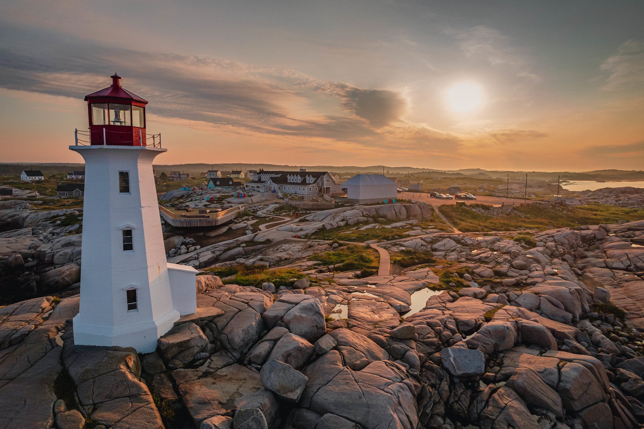
Peggys Cove Lighthouse
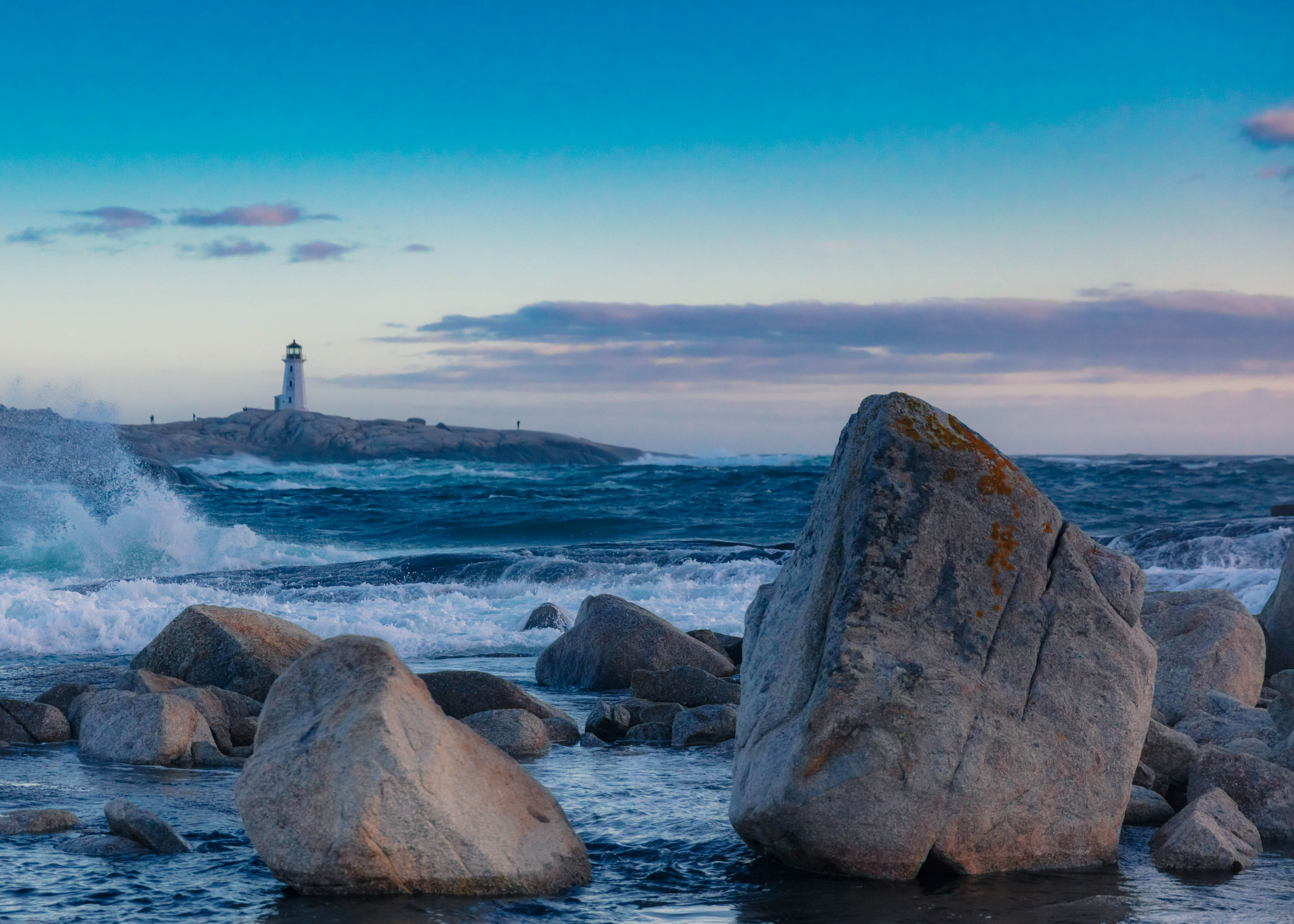
Let's get the obvious one out of the way first: the definitive Nova Scotia bucket list shot is Peggy's Cove. It's easily the most photographed location in the province. Throngs of tourists and buses from all over the world come here each summer. Head to the South Shore and start here in the morning. Also, try and avoid it during peak season, unless you want a photo full of people holding their phones out in front of them, trying to document proof they were there, that one time.
Go at sunrise, and not only for the light: by mid-morning the tour buses own the place, but at dawn you can work the lighthouse from the granite shelves in near solitude.
Despite being a tourist mecca, Peggy's Cove is a must-visit for any photographer. The photographic opportunities are near limitless, and even overrun it keeps an authenticity that is uniquely Canadian.
Photo by Shawn M. Kent
Peggy's Cove done, let's keep working down the South Shore to...
Lunenburg and Mahone Bay
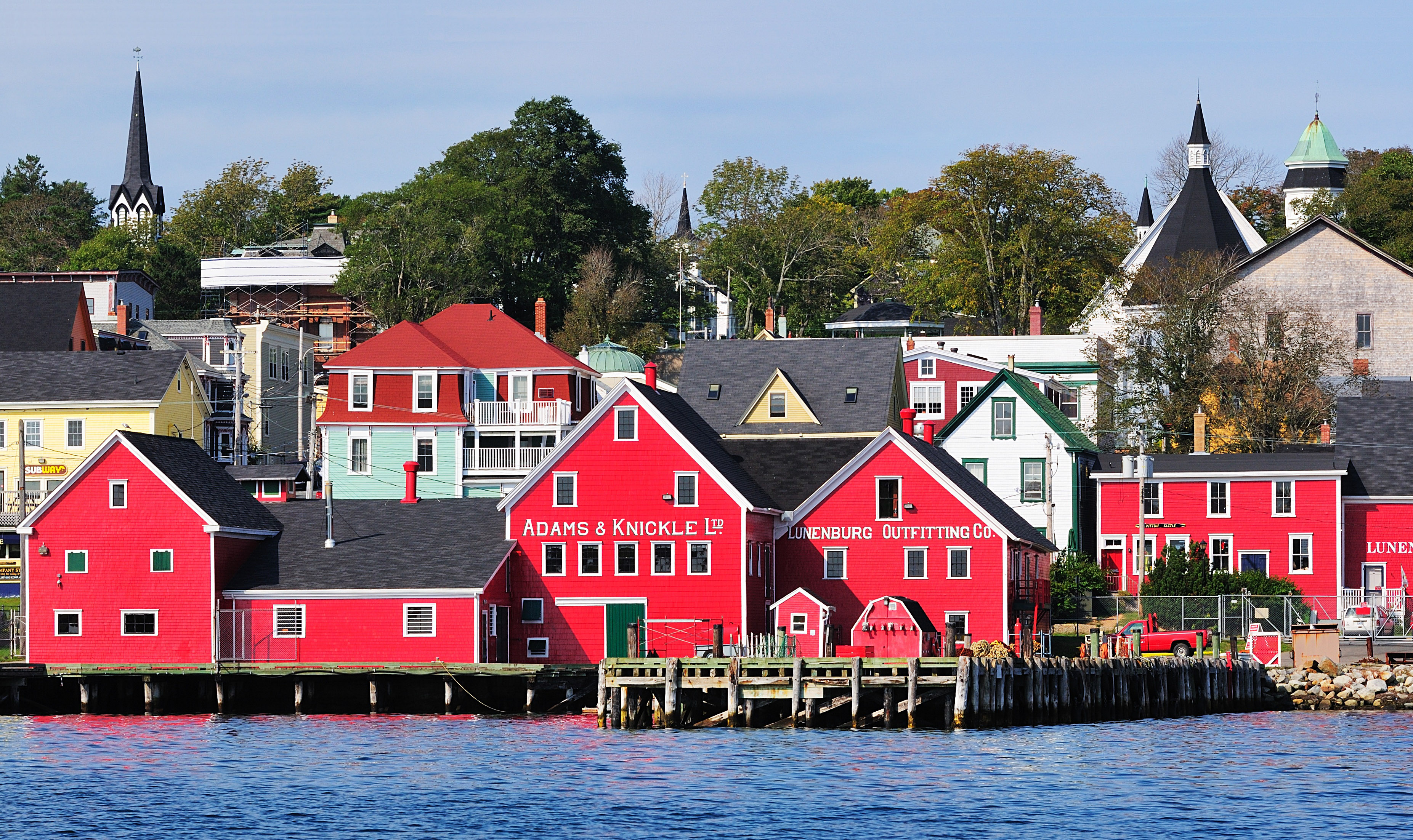
Lunenburg Nova Scotia - Photo by Wladyslaw
Half an hour down the coast, Lunenburg is the postcard that earned UNESCO status: a working waterfront of red and yellow buildings that photographs best from across the harbour at golden hour, when the fleet is in and the water goes still. Bring a long lens for the compression shot across the bay, capture the Fisheries Museum of the Atlantic and wander the hill streets after, where the J.C. Williams Dory Shop has been building boats since 1905 and looks every year of it, in the best way.
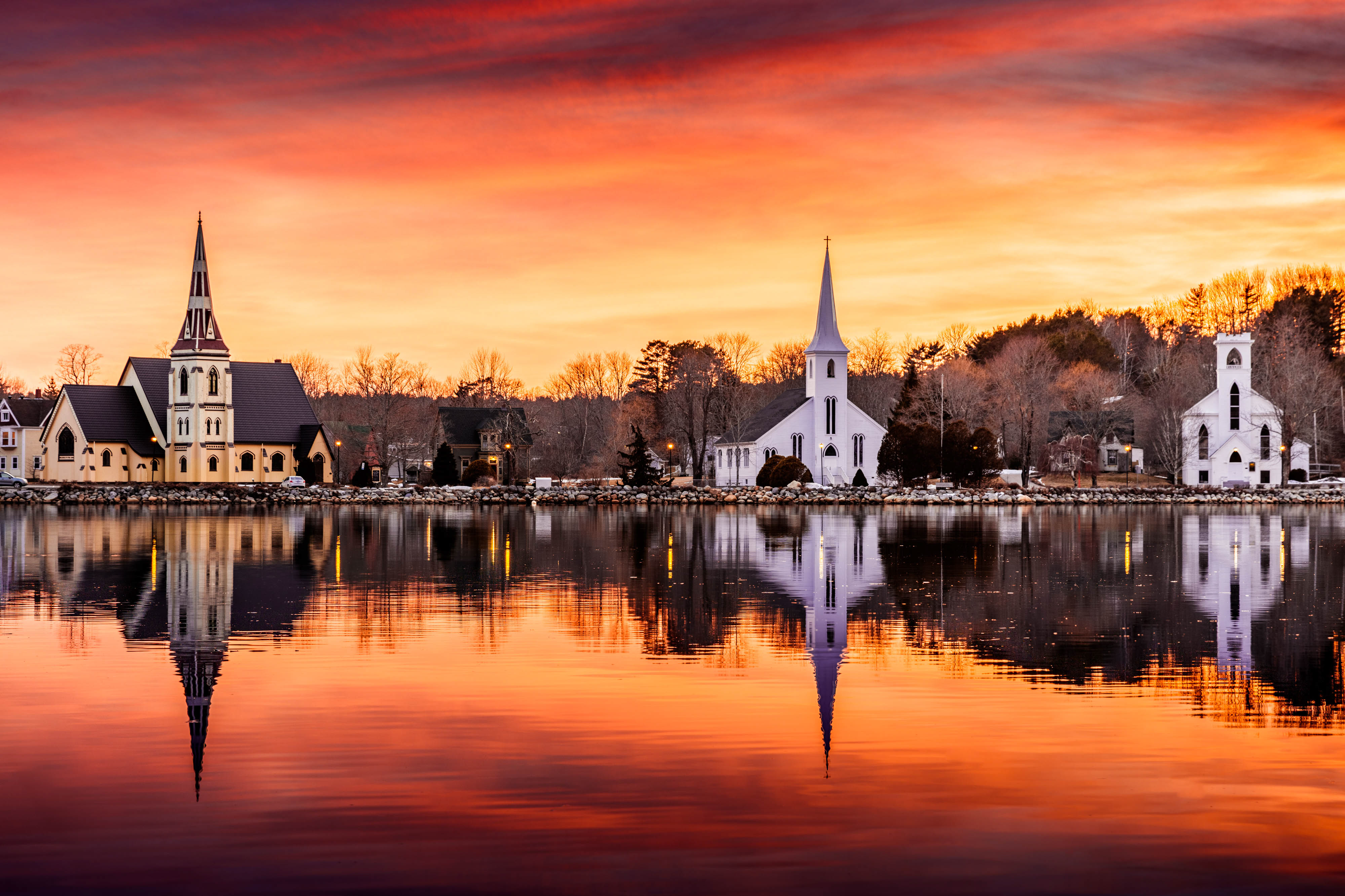
Three Churches of Mahone Bay - Photo by Shawn M. Kent
Then backtrack to Mahone Bay for the three churches lined along the water, the reflection shot every Nova Scotia calendar owes royalties to. Calm mornings only; wind kills the mirror.
📷 Photo Tip
People ask if the shot above really looked like that. It did. But there's a secret: the best sunset shots are actually sunrises. This one was made on a cold spring morning, and that's the whole trick: chase sunrises, not sunsets, and favour the colder months. There's science behind it. Cold air holds less moisture, so there's less haze to mute the light, and overnight the wind dies and the dust settles, which is why dawn water sits mirror-still while sunset water ripples. Add a low-riding winter sun that stretches golden hour longer, and you get richer colour, cleaner air, glassier reflections, and as a bonus, nobody standing in your frame.
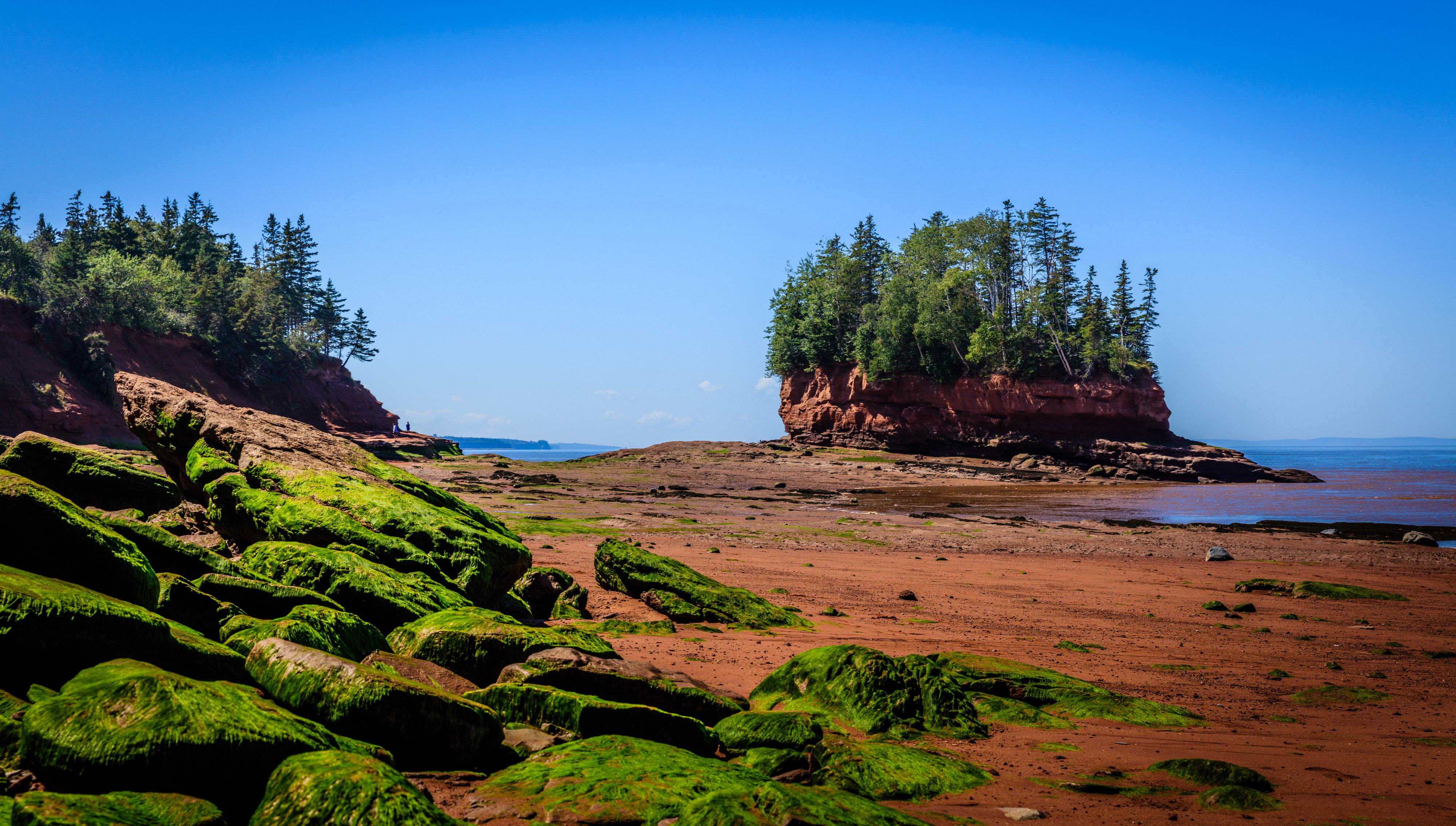
Day two of your photographic adventure has you headed north. First stop is a spot most visitors never find: Burntcoat Head Park. Situated on the shores of the Bay of Fundy, this is where the highest tides ever recorded on Earth were measured, and twice a day the ocean simply leaves. At low tide you walk out onto the sea floor itself, red mud and rockweed underfoot, and shoot the flowerpot formations from angles that will be underwater by dinner. Time it with a tide table and give yourself the full window; the light on the wet mud at golden hour is worth planning a whole day around. Read our Burntcoat Head Park guide before you go.
The tides that empty Burntcoat Head work the whole shore. At Balancing Rock on Digby Neck, a basalt column stands improbably on its end above St. Marys Bay, a short hike and 235 stairs from the road, and worth every one of them. Five Islands Lighthouse gives you the classic red-and-white against the Minas Basin's red cliffs, and at Advocate Harbour the fishing boats settle onto the sea floor at low tide, still tied to their wharf. And then there's Cape Split, the headland hike that ends at cliffs above the full force of the Fundy tide, and the location that inspired PIXEO in the first place. We owe this coast everything. One tide table plans your whole day on it.
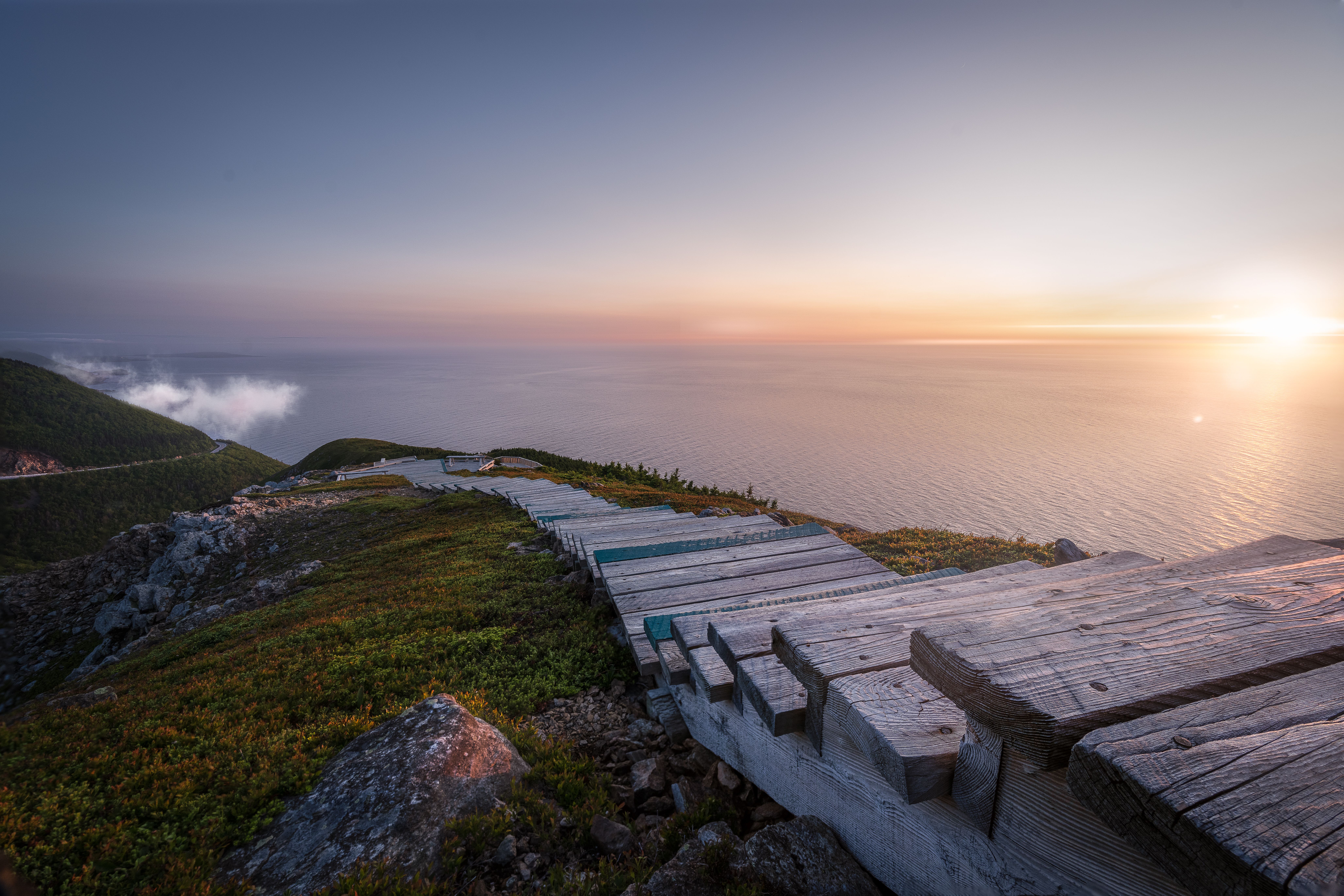
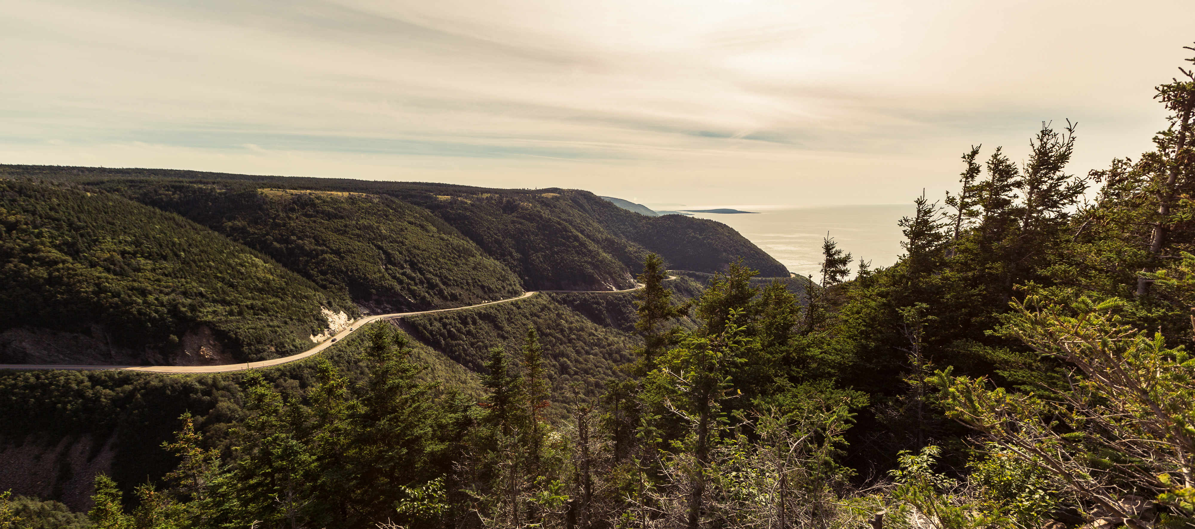
Your last day belongs to the Cabot Trail, the drive photographers cross the country for, and the Skyline Trail is its money shot: a boardwalk ridge above the gulf where the road curls along the mountainside below you. Shoot it at sunset and stay for the blue hour; watch for moose on the walk out, and we mean that both as a photo tip and a warning.
Cabot Trail - Photo by Tony Webster
PIXEO maps over 400 photography locations in Nova Scotia, and this guide barely dents the list: the waterfalls alone could fill another one. So for good measure, here are a few more fantastic spots to explore, and when you're done, browse the full Nova Scotia collection and build your own route.






Comments
Loading comments…